


Article written by: Holly Callahan
The new Otter Spotter submission form and sightings map are now live via Woodland Park Zoo’s website. For more information on this project, see the news post here.
The new submission form and map allows new users to easily engage in the experience, it will encourage returning users to continue submissions of otter sightings, and it will allow for community science river otter information to be utilized effectively.
The new submission form was created using Google Script. This allows the form’s information to be submitted into a Google Sheet, where Dr. Michelle Wainstein and other scientists can easily access sighting information. The form also allows users to find their location on a map, or if they are at the location of the sighting, to get their current location. This provides more accurate sighting information for scientists and usability for otter observers.
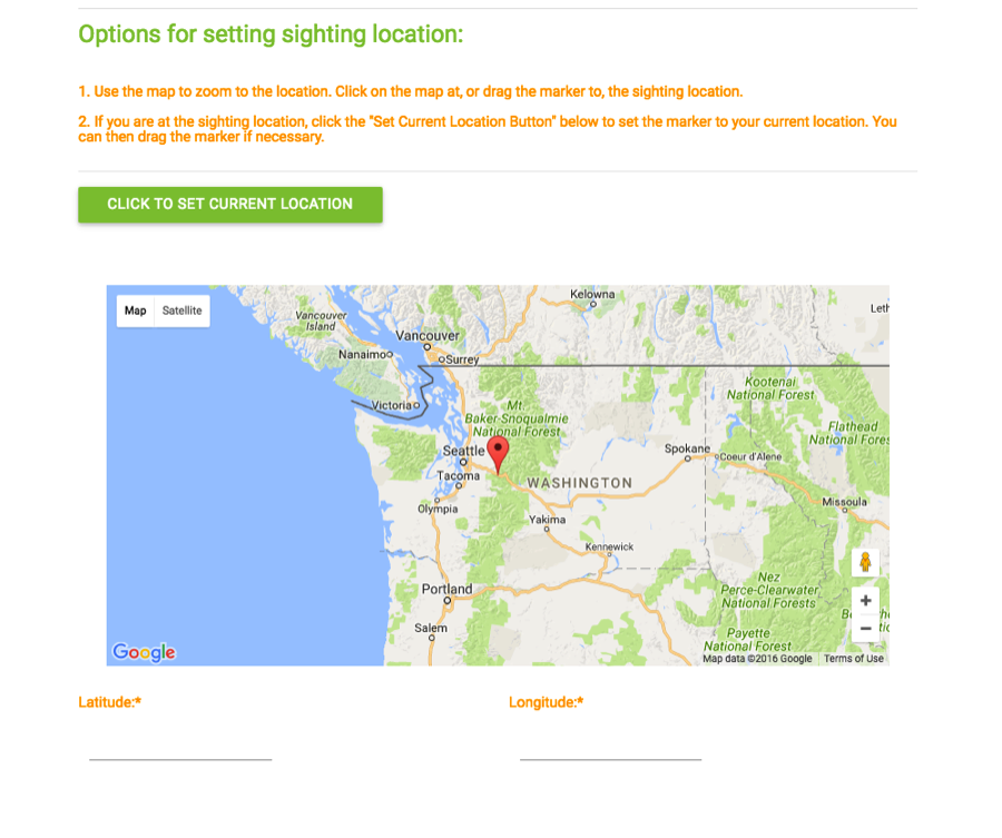 > The new location options on the otter spotter submission form.
Otter spotters may also submit photos to the form that will appear on the submissions map. Using Google Scripts allows us to store the photos in Google Drive and display them on the sightings map page with the permission of the submitter.
The submissions map allows community participants to view their submissions and those of others. The map uses a library called Sheetsee, which was created by Jessica Lord to pull information from Google Sheets into charts, tables or maps. This allowed us to use submissions from the Google Sheet to create a Mapbox map.
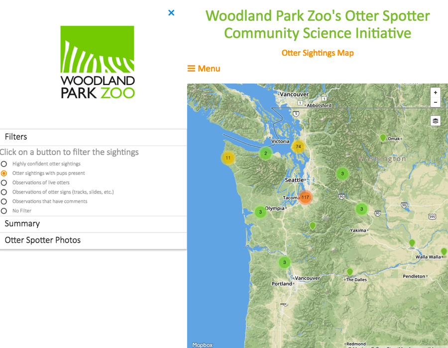 > Users can see and filter otter sightings on the map.
The map allows users to interact with the submissions, filtering them based on characteristics of the submissions, adding layers of the Duwamish and Green Rivers (focus areas for the current research), to view a summary of the submissions, and photos submitted by participants.
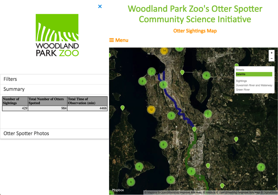 T> he map has various options for base maps and layers, and has sections for users to view summaries of the sightings and submitted photos.
Using these methods of creating the submission form and the map, sightings will appear on the map immediately after form submission. The original submission form did not populate a map and required manual geocoding, leaving researchers and visitors effectively unable to view the data spatially. This enhancement offers critical added functionality for scientific and engagement efforts.
It has been a great experience to work on this project with the Woodland Park Zoo. Be sure to submit any local otter spottings here!