


In a previous blog post [http://news.spatialdev.com/supporting-climate-smart-agriculture-through-the-use-of-data-informed-decision-making/], we introduced the project we’re working on with the International Center for Tropical Agriculture (CIAT), USAID Feed the Future program, and USAID GeoCenter to support and expand USAID Mission use of geospatial technologies. Since then, we’ve concluded our field visits with a final trip to the USAID office in Nepal. Our trip was initially delayed by the devastating earthquakes in April and May, but once most of Kathmandu was back to normal, our week on the ground was very successful.
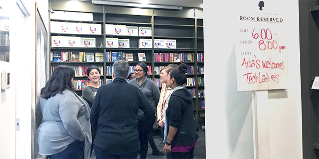
We met with government officials, USAID mission representatives, local implementing partners, and organizations such as Save the Children and the World Food Programme. The connections made during these in-person meetings established deeper levels of understanding in how best to apply our own tools to help drive the adoption of Climate Smart Agriculture interventions, and also how some of these tools are currently being used on the ground in Nepal.
One particularly motivating aspect of the trip was hearing the enthusiasm around data and information sharing. Several of the stakeholders had already begun the process of collecting and analyzing their own data, and were enthusiastic about the prospect of leveraging each other’s datasets to better understand their impact within the regional context. Since SpatialDev has been involved in the SERVIR program for years, it was great to hear that information and tools coming out of ICIMOD (http://www.icimod.org/?q=471) are being widely used.
Some of the types of data currently being collected and analyzed by implementing partners include:
- Baseline surveys from rural farmers growing lentils, rice, maize, and vegetables
- Monitoring & Evaluation (M&E) data from a variety of interventions which improve the quality and availability of seeds, fertilizers, and credits to farmers
- Geolocation data of commercial market pockets, and farmer training centers
- Rainfall and Satellite Data from the Department of Hydrology and Meteorology
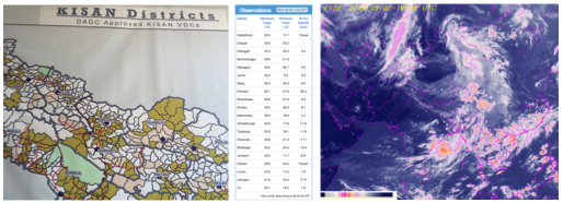
Some example datasets currently being collected by (1) KISAN and (2) Hydromet
That’s where we come in.
SpatialDev’s experience in understanding geospatial data and building tools around it, and CIAT’s expertise in practical applications of agricultural research make this an ideal partnership. Together, we’re combining that knowledge to curate data and create a web-based application to leverage the information being collected by these various groups. The resulting application will allow the USAID mission in Nepal and its implementing partners to visualize and share their information in meaningful ways and begin answering important questions such as:
- What is the full geographic extent of the work we are supporting?
- How do our projects fit within the context of other projects occurring in the area?
- How do we know if our projects having an impact?
We’ve aggregated the knowledge and information collected from each of the missions we visited in Nepal, Bangladesh, Ethiopia, and Senegal to inform the design and implementation of a robust project mapping tool. The intent is that USAID and its implementation partners can better use their information to make key programming decisions along side their government partners to ultimately increase the impact of everyone’s work.